Coastal environment
People, waves, tides, weather, water conditions, and rescue coverage
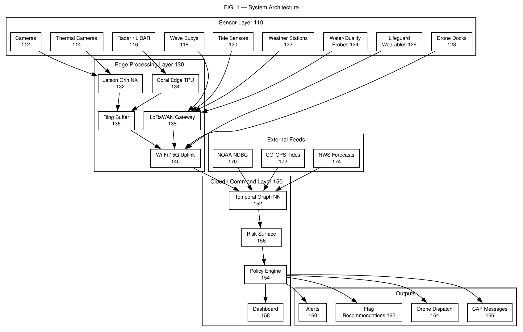
ShoreSense is a camera-and-sensor-agnostic architecture that combines physical coastal infrastructure with edge computer vision, environmental forecasting, a littoral digital twin, and human-reviewed rescue coordination.
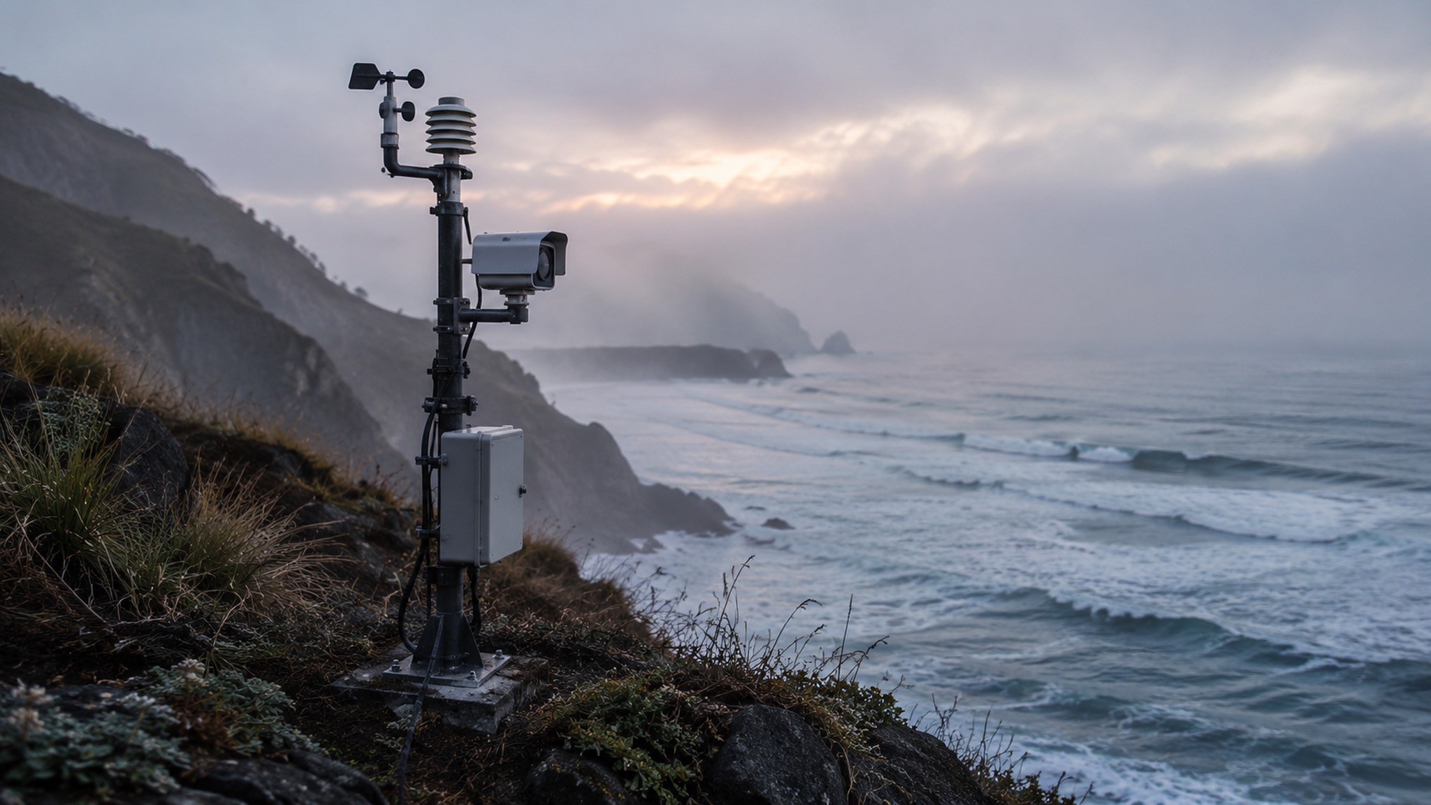
The system is built to preserve context as data moves from the coast to a decision. Each stage adds a different form of understanding.
People, waves, tides, weather, water conditions, and rescue coverage
Distributed cameras, environmental nodes, connected coastal feeds, and responder locations
Person detection, tracking, optical flow, hazard segmentation, and privacy-aware local processing
Adaptive shoreline cells connect people, sensors, hazards, and rescue assets
Localized risk and uncertainty are estimated now and across 5, 15, and 30 minute horizons
Warnings, patrol positioning, rescue staging, routing, and human-reviewed decisions
The prototype accepts visual, environmental, and operational inputs through a flexible sensing layer. Local processing keeps the system responsive even when connectivity is limited.
Distributed shoreline cameras, environmental sensor nodes, wave and tide inputs, weather and water-condition feeds, and responder locations create the physical picture of the site.
A local edge gateway synchronizes observations and runs safety-relevant visual analysis close to the source. Event metadata can move upstream without continuously transmitting full video.
The same architecture can incorporate existing public data feeds, beach-specific sensor networks, and the positions of lifeguards, rescue boards, watercraft, and other response assets.
Potential distress cannot be understood from a single frame. ShoreSense links detections across time, analyzes movement, and evaluates them alongside changing water conditions.
Camera streams enter the local processing gateway.
Detection and multi-object tracking maintain continuous swimmer trajectories.
Pose, direction, offshore drift, submergence, and purposeful motion are analyzed over time.
Optical flow and segmentation estimate hazardous current structure and surf-zone change.
Visual outputs are fused with tide, waves, shoreline geometry, visibility, and uncertainty.
The littoral digital twin represents the coast as adaptive georeferenced cells. Tracked people, sensor nodes, hazards, and rescue assets become connected parts of one changing model.
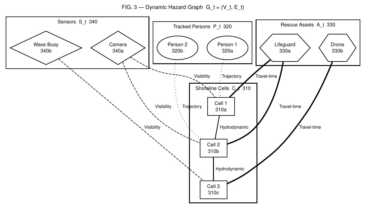
Every update produces localized estimates instead of one beach-wide label. The forecasting layer projects how conditions may evolve and keeps uncertainty visible to the operator.
An end-to-end prototype demonstration moves through one continuous sequence.
Camera streams, environmental observations, public coastal feeds, and responder locations are synchronized and georeferenced.
Edge models track swimmers, analyze temporal behavior, estimate optical flow, and identify changing hazard structure.
Localized cells connect physical conditions with people, sensors, visibility, rescue coverage, and uncertainty.
The fusion layer estimates how hazards and exposure may evolve across immediate and future horizons.
ShoreSense recommends warnings, patrol positioning, rescue staging, and asset routing for trained human review.
U.S. Patent Application No. 64/117,500 covers the integrated system architecture, including multimodal sensing, adaptive shoreline cells, temporal risk modeling, and rescue-resource orchestration.
person-in-water detection accuracy across controlled prototype evaluations
Evaluation has combined recorded coastal footage, public datasets, field data, and simulated hazard, distress, and rescue-coordination scenarios.
See the scientific foundationThe environmental-intelligence layer grew from work on offshore wave spectra and coastal water-level oscillations.
Explore the research