Menu
Hidden in the Spectrum
Geographic Transfer of an Offshore Wave Index for Coastal Water-Level Oscillations
Manuscript under review
View the manuscript
Bulk wave measurements leave part of the story behind.
Wave height and peak period summarize an offshore sea state in two familiar numbers. They do not preserve how energy is distributed across the full spectrum.
The study tests whether a low-frequency-weighted spectral index carries information that transfers more effectively from Pacific Northwest development sites to a separate California evaluation network.
The index gives more weight to lower-frequency energy.
Two sea states can have similar wave height and peak period while distributing energy very differently. Negative spectral moments preserve more of the lower-frequency structure that bulk measurements omit.
The resulting value is used as a compact offshore descriptor. It becomes one environmental input within ShoreSense, alongside visual observations, tides, weather, local geometry, and other site data.
A model developed in one region was tested in another.
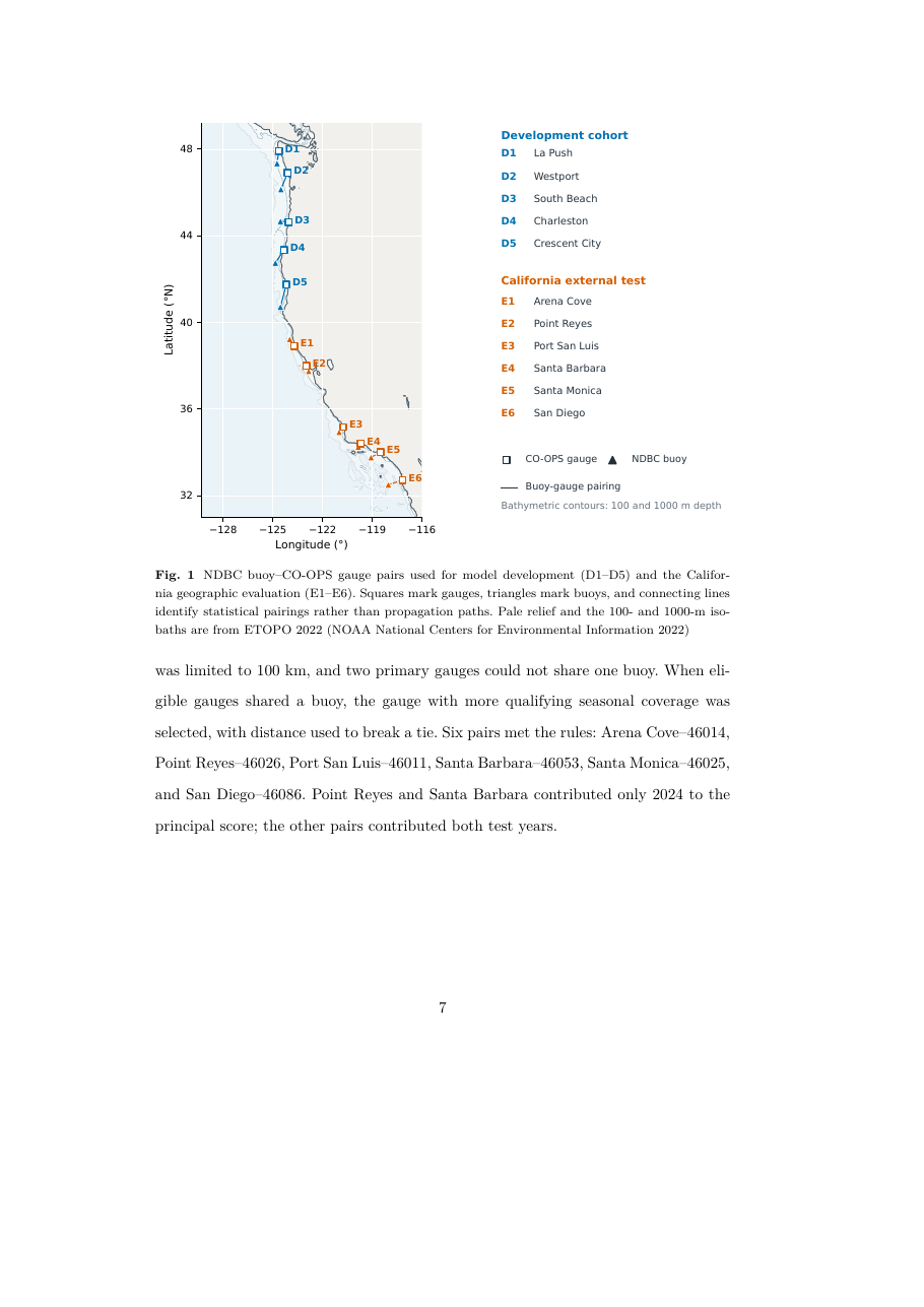
Five Pacific Northwest buoy-gauge pairs supplied the development observations. The fixed relationships were then evaluated at six California pairs spanning Arena Cove to San Diego.
California outcomes did not determine the spectral moment or model coefficients. The evaluation asked whether the ordering would persist across new coastal settings.
The spectral model improved the primary comparison at all six California sites.
The strongest pooled result used preliminary one-minute water levels. The verified six-minute product preserved the pooled ordering with a smaller improvement.
lower normalized RMSE
for the preliminary one-minute target against the prespecified height-period comparator across the 24,878-observation California evaluation.
From coastal research to environmental intelligence.
The manuscript contributes a geographically tested environmental covariate. ShoreSense places that kind of spectral information inside a larger system that also considers camera observations, local conditions, human movement, and response coverage.
See how the research becomes a system.
Explore the sensing hardware, edge models, littoral digital twin, and response-coordination architecture.
Explore the system